Guide · Algarve
The Fishermen's Trail in the AlgarveOdeceixe to Sagres stage by stage
The five Algarve stages of the Rota Vicentina Fishermen's Trail from Odeceixe to Sagres, with official distances and times, which stages suit a half day or a family, the easier Historical Way alternative, luggage transfers and buses back.
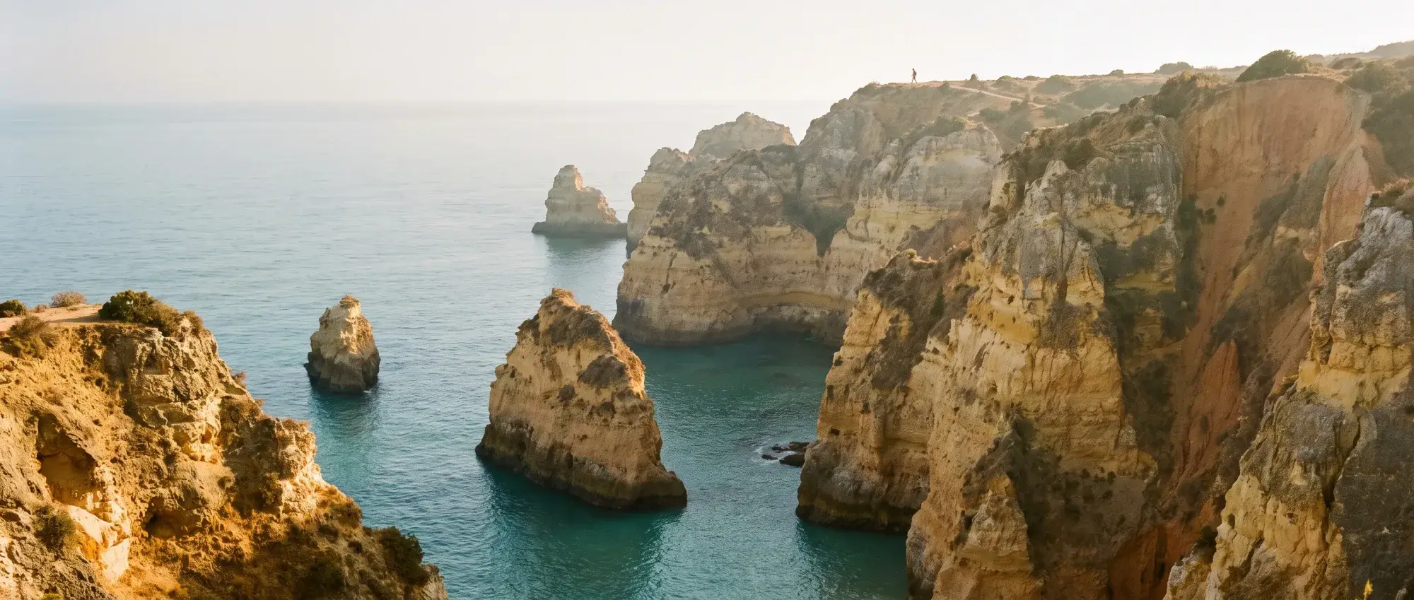
Checked on 4 October 2026. Distances and times below are the official Rota Vicentina figures. We have not walked these stages ourselves for this page; where a blog adds detail, it says so.
The short answer
The Fishermen’s Trail is a coastal footpath of 13 one-day stages and about 226 km along Portugal’s south-west coast, from São Torpes in the Alentejo to Lagos [1][2]. The Algarve part starts at Odeceixe and runs five stages south to Sagres, roughly 95 km, before turning east along the south coast to Lagos [2].
It is harder than the distances suggest. Rota Vicentina calls it “somewhat difficult”, says 60–70 % of the path is sand, and does not recommend it to anyone with vertigo or a fear of heights [1]. The official walking season is September to June [1].
If you want the coast without the full commitment, pick one stage, or a half of one, and use the bus or a taxi back. If you have children or tired legs, the inland Historical Way covers the same towns on easier ground [5][6].
The five Algarve stages
| Stage | Distance | Walking time | Official difficulty |
|---|---|---|---|
| 6 · Odeceixe » Aljezur | 22.6 km | 5 h 50 | Difficult |
| 7 · Aljezur » Arrifana | 17.1 km | 4 h 46 | Moderate |
| 8 · Arrifana » Carrapateira | 19.4 km | 5 h 10 | Moderate |
| 9 · Carrapateira » Vila do Bispo | 15.3 km | 4 h 18 | Moderate |
| 10 · Vila do Bispo » Sagres | 20.2 km | 5 h 18 | Moderate |
Source: Rota Vicentina’s stage list on Outdooractive [2]. Times are walking time without stops. Beyond Sagres the trail continues as stage 11 to Salema (19.6 km, difficult), 12 to Luz (11.5 km) and 13 to Lagos (10.9 km, easy) [2].
Odeceixe » Aljezur. The longest Algarve stage and the only one rated difficult [2]. It starts back at Odeceixe beach on the Algarve side of the river. A blog that walked it in 2026 counts +288 m of climbing and notes a bus stop at Rogil, about 14.5 km in, which is a natural bail-out point [7].
Aljezur » Arrifana. Past Monte Clérigo beach and the headland of Ponta da Atalaia [11]. The same blog reports 4–5 km through sand on this stage, the sandiest stretch of the Algarve section in its log, and says Arrifana has no ATM or pharmacy [7].
Arrifana » Carrapateira. Cliffs up to 100 m high [12]. It ends inland: Carrapateira village sits about 3 km from the sea [7], so plan the last kilometres and where you sleep before you set off.
Carrapateira » Vila do Bispo. The shortest of the five, but the blog rates it its hardest Algarve day and warns there is no food or water between roughly km 2.5 and km 15 [7]. Officially it is moderate, with 302 m of ascent, and passes Amado, Murração and Manteiga beaches and the 12th–13th-century Islamic-era fishing settlement at Ponta do Castelo [3].
Vila do Bispo » Sagres. The flattest stage, with only 114 m of ascent [4]. It starts at the church square in Vila do Bispo, passes Telheiro beach and Cabo de São Vicente, and ends at the garden next to the Sagres tourism office [4]. Rota Vicentina warns that there is nowhere to buy food or water until the lighthouse, so carry everything [4].
Which stage for a half day or a family
There is no official family rating, so this is our reading of the official figures, not a walked recommendation.
- Cabo de São Vicente to Sagres. The last part of stage 10, from the lighthouse back to Sagres, is the easiest piece of the whole Algarve section to do on its own: the ground is flat by this trail’s standards [4], there is a café at the cape, and the Vamus 47 bus stops at both ends [9]. Cliff edges run alongside, so hold small hands.
- Historical Way, Aljezur » Arrifana. 11.8 km, about 3 h 17, rated easy [5]. It ends in the same place as the Fishermen’s Trail stage, so you can walk inland and still finish at Arrifana beach.
- Historical Way, Vila do Bispo » Cabo de São Vicente. 13.6 km, 3 h 24, easy [5]. A softer alternative to stage 10.
The Historical Way in brief
The Historical Way is the inland twin of the Fishermen’s Trail: 263 km in 13 sections, rated easy overall, on dirt roads and paths through villages, cork oak and farmland rather than cliff tops [6]. Its Algarve stages are [5]:
| Stage | Distance | Time | Difficulty |
|---|---|---|---|
| Odeceixe » Aljezur | 19.7 km | 5 h 03 | Easy |
| Aljezur » Arrifana | 11.8 km | 3 h 17 | Easy |
| Arrifana » Carrapateira | 23.9 km | 6 h 30 | Moderate |
| Carrapateira » Vila do Bispo | 21.4 km | 5 h 37 | Easy |
| Vila do Bispo » Cabo de S. Vicente | 13.6 km | 3 h 24 | Easy |
It is the better choice on hot days, in strong north wind on the cliffs, or when the sand of the coastal path is too much for small legs.
When to go
Rota Vicentina’s walking period is September to June [1]. Summer is outside it: much of the path has no shade, and the stage descriptions repeatedly note that water and food are scarce between villages [4][7].
Spring and autumn are also when the logistics fill up. The luggage-transfer company Vicentina Transfers says its service can sell out in April–May and September–October, and advises booking it at the same time as your rooms [8].
Luggage, buses and getting back
Bags. Several companies move luggage between stage ends. Vicentina Transfers says it has run the service since 2017 and covers every stage from Porto Covo to Lagos [8]; we did not compare prices across operators.
Buses. The south end is easy. The Vamus line 47 runs Lagos – Salema – Vila do Bispo – Sagres, and some departures continue to Cabo de São Vicente. In the Vamus timetable data, buses leave the cape for Sagres and Lagos at 11:45, 15:50 and 16:50 on weekdays, and at 11:45 and 13:45 at weekends and on holidays, plus 16:50 at weekends from May to October [13]. The Lagos–Sagres fare is €6.20 [9]. Several departures run on weekdays or schooldays only, so check the current timetable for your day.
The north end is thinner, and weekdays only. Vamus line 79 runs Lagos – Aljezur – Rogil – Odeceixe: in October and November, outside school holidays, five buses a day each way, leaving Lagos at 08:30, 09:15, 13:55, 16:40 and 18:30 and reaching Aljezur in 52–65 minutes; around Christmas only three. Line 74 loops from Aljezur to Arrifana about six times a weekday. Carrapateira gets line 22 only on Mondays and Fridays: 08:10 from Vila do Bispo, back from Carrapateira at 12:57. Nothing on these lines runs at weekends [13]. Outside those hours, budget for a taxi or a pre-booked transfer, and check the current timetable before you go.
Safety on the cliffs
- Stay on the marked path and away from the edge. Rota Vicentina asks walkers to “be careful of the danger of falling” and states that people walk under their own responsibility [1].
- Respect diversions. In the Alentejo, the stage into Odeceixe has been diverted around a collapse-risk area near Praia da Amália; in October 2024 Rota Vicentina said the diversion had been in place for two years and that some people still use the closed section [10]. If you see a diversion, follow it.
- On foot only. No bikes or running on the Fishermen’s Trail, no vehicles in the dunes, no wild camping, and groups of 15 at most [1].
- Wind and water. Carry more water than the distance suggests. On the exposed plateau sections between Carrapateira and Sagres there is little or no supply [3][4][7].
What we’d do
For a first taste from Sagres, we would take the bus to Cabo de São Vicente in the morning and walk back to town on the last part of stage 10. For a full day, we would do Carrapateira » Vila do Bispo for the scenery, with plenty of water and a lift back arranged in advance [3][7]. With children, we would start with the Historical Way from Aljezur to Arrifana and finish on the beach [5].
Sources
- Rota Vicentina: Fishermen’s Trail, accessed 4 October 2026.
- Outdooractive (Rota Vicentina): Fishermen’s Trail, all 13 stages, accessed 4 October 2026.
- Outdooractive (Rota Vicentina): Carrapateira » Vila do Bispo, accessed 4 October 2026.
- Outdooractive (Rota Vicentina): Vila do Bispo » Sagres, accessed 4 October 2026.
- Outdooractive (Rota Vicentina): Historical Way, all stages, accessed 4 October 2026.
- Rota Vicentina: Historical Way, accessed 4 October 2026.
- Stingy Nomads: Fishermen’s Trail itinerary (updated 28 Feb 2026), blog, accessed 4 October 2026.
- Vicentina Transfers: Fishermen’s Trail guide, operator, accessed 4 October 2026.
- algarvebus.info: Vamus 47 timetable, enthusiast site, accessed 4 October 2026.
- Rota Vicentina blog: Update on the risk of landslides (25 Oct 2024), accessed 4 October 2026.
- Outdooractive (Rota Vicentina): Aljezur » Arrifana, accessed 4 October 2026.
- Outdooractive (Rota Vicentina): Arrifana » Carrapateira, accessed 4 October 2026.
- Vamus Algarve GTFS feed, via Transitland, version 25 September 2026, counted day by day, accessed 11 October 2026.
Source references
- Rota Vicentina: Fishermen's Trail (226.5 km, 13 one-day stages, September–June, 60–70 % sand, 'somewhat difficult', no wild camping, max 15 per group, vertigo warning) · accessed
- Outdooractive (author Rota Vicentina): Fishermen's Trail, long-distance: 13 stages S. Torpes » Lagos, 221.7 km, 59:40 h, distances/times/difficulty per stage · accessed
- Outdooractive (Rota Vicentina, verified partner): Carrapateira » Vila do Bispo: 15.3 km, 4:18 h, ascent 302 m, moderate; Amado, Murração, Manteiga; Ponta do Castelo Islamic-era site · accessed
- Outdooractive (Rota Vicentina): Vila do Bispo » Sagres: 20.2 km, 5:18 h, ascent 114 m, moderate; starts at the church square, ends at the Sagres garden by the tourism office; no supply point before the lighthouse · accessed
- Outdooractive (Rota Vicentina): Historical Way, long-distance: stages and distances incl. Odeceixe » Aljezur 19.7 km … Vila do Bispo » Cabo de S. Vicente 13.6 km · accessed
- Rota Vicentina: Historical Way (263 km, 13 one-day sections, easy, September–June) · accessed
- Stingy Nomads: Fishermen's Trail walking itinerary (updated 28 Feb 2026): per-day ascent, sand, water and services notes (blog, own GPS figures) · accessed
- Vicentina Transfers: Fishermen's Trail guide (luggage transfer since 2017, all stages Porto Covo–Lagos; can sell out April–May and September–October) · accessed
- algarvebus.info: Vamus line 47 Lagos–Salema–Vila do Bispo–Sagres–Cabo São Vicente timetable (enthusiast site, from printed timetables) · accessed
- Rota Vicentina blog: Update on the risk of landslides on the Fishermen's Trail (25 Oct 2024) · accessed
- Outdooractive (Rota Vicentina): Aljezur » Arrifana: 17.1 km, 4:46 h; Monte Clérigo beach and Ponta da Atalaia (search-result summary) · accessed
- Outdooractive (Rota Vicentina): Arrifana » Carrapateira: 19.4 km, 5:10 h; cliffs up to 100 m (search-result summary) · accessed
- Vamus Algarve GTFS feed (published by TRENMO, version 25 Sep 2026, via Transitland), counted for Mon 12, Tue 13, Fri 16, Sat 17, Sun 18 Oct, Tue 17, Sat 21, Sun 22 Nov and Tue 22 Dec 2026: line 47 cape departures 11:45, 15:50, 16:50 Mon–Fri, 11:45, 13:45 Sat/Sun (+16:50 May–Oct); line 79 Lagos–Aljezur–Odeceixe 5 a day each way on schooldays, 3 in school holidays, none Sat/Sun; line 74 Aljezur–Arrifana loop 6 on weekdays; line 22 Vila do Bispo–Carrapateira–Aljezur Mon and Fri only · accessed
Quick answers
How long is the Fishermen's Trail?
Rota Vicentina gives 226.5 km in 13 one-day stages; its Outdooractive listing of the same 13 stages (São Torpes to Lagos) totals 221.7 km and 59 h 40 of walking. The longest stage is about 22.5 km (rotavicentina.com; outdooractive.com, accessed 4 Oct 2026).
Which stages of the Fishermen's Trail are in the Algarve?
From Odeceixe south: Odeceixe » Aljezur (22.6 km), Aljezur » Arrifana (17.1 km), Arrifana » Carrapateira (19.4 km), Carrapateira » Vila do Bispo (15.3 km) and Vila do Bispo » Sagres (20.2 km), then on along the south coast to Salema, Luz and Lagos (Rota Vicentina on Outdooractive, accessed 4 Oct 2026).
When is the best time to walk the Fishermen's Trail?
Rota Vicentina recommends walking it between September and June. Luggage-transfer operator Vicentina Transfers says its service can sell out in April–May and September–October (rotavicentina.com; vicentinatransfers.pt, accessed 4 Oct 2026).
Is the Fishermen's Trail hard?
Rota Vicentina rates it 'somewhat difficult': 60–70 % of the path is sand, it runs along cliff edges and it is not recommended for people with vertigo or a fear of heights. In the Algarve section, Odeceixe » Aljezur is rated difficult and the other four moderate (rotavicentina.com; outdooractive.com, accessed 4 Oct 2026).
Can you walk the Fishermen's Trail with children?
There is no official family rating. The parallel Historical Way is rated easy overall, and its Aljezur » Arrifana stage is 11.8 km; on the coast, the last stretch of Vila do Bispo » Sagres from the lighthouse at Cabo de São Vicente is short and has a café at the start (outdooractive.com, accessed 4 Oct 2026). Cliff edges are the main risk.